Yours for £9,000 – an exceedingly rare historic Jewish Map of the East End
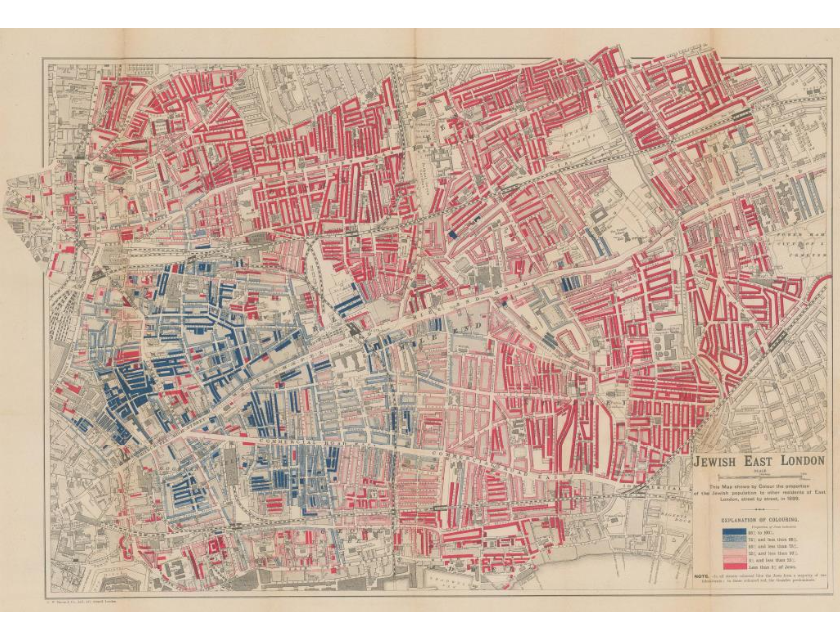
I love love LOVE historical research. It takes you down a rabbit hole of routes, ideas and information and brings up the most incredible, exciting finds. In looking at women of the East End, I’ve come across an exceedingly RARE map of the Jewish East End. First published in 1899, it’s a detailed survey at the close of the Victorian Era. It explores Jewish districts, street by street. It was originally surveyed by George Arkell, a cab driver and sociologist who worked on Charles Booth’s famous survey of London poverty, The colouring indicates the proportion of Jewish residents on every street in the survey area ranging from blue (95-100%) to red (less than 5%).The map covers Whitechapel, Shoreditch, Mile End, Bethnal Green, Wapping, Shadwell, and Stepney. The vast majority of Jewish immigrants to Britain in the 19th century lived in, or passed through, these parts of the East End. A lovely lady at the Map House of London in Knightsbridge, which as London’s oldest specialist antiquarian map seller, carries maps from the 15th century, priced this particular Arkell copy at £9,000.